
As we inch towards the weekend, expect noticeable changes starting today and lasting through Saturday.
A troughing pattern to our north, bringing rain and extreme weather to the country's northern half, will increase onshore flow for southern California. These changes will enhance the marine layer each morning with slow clearing and the potential for drizzle and heavy mist, especially on Saturday.
Winds out of the west and southwest increased overnight. Each night, isolated gusts up to 55mph will target the mountains and deserts, with sustained winds up to 30mph peaking Friday through Saturday morning.
Today will be cooler, and temperatures will continue to drop through Saturday. Sunday is our transition day into a warming pattern, with temperatures climbing 10-15 degrees on Memorial Day. By Monday, daytime highs will be near seasonal in the upper 70s inland and upper 60s along the coast.
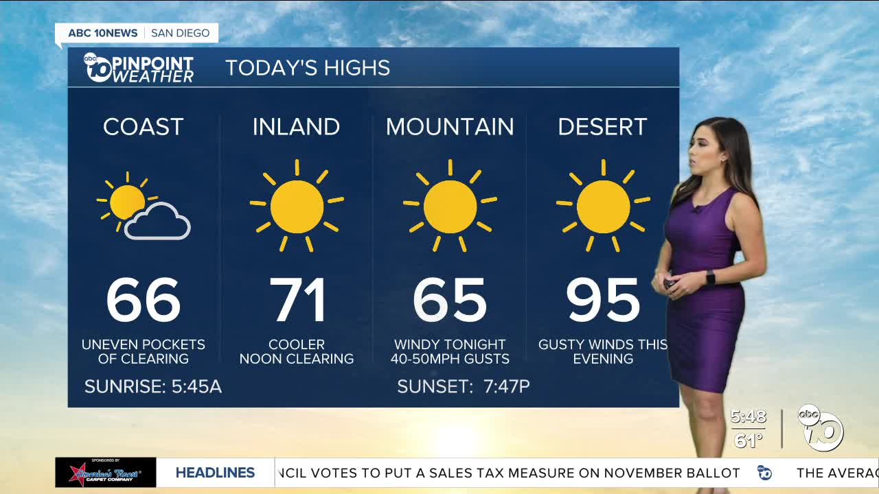
Thursday's Highs:
Coast: 66-69°
Inland: 69-74°
Mountains: 68-78°
Deserts: 94-98°
For the latest news, weather and traffic updates, follow Vanessa Paz on Facebook, Twitter and Instagram.
