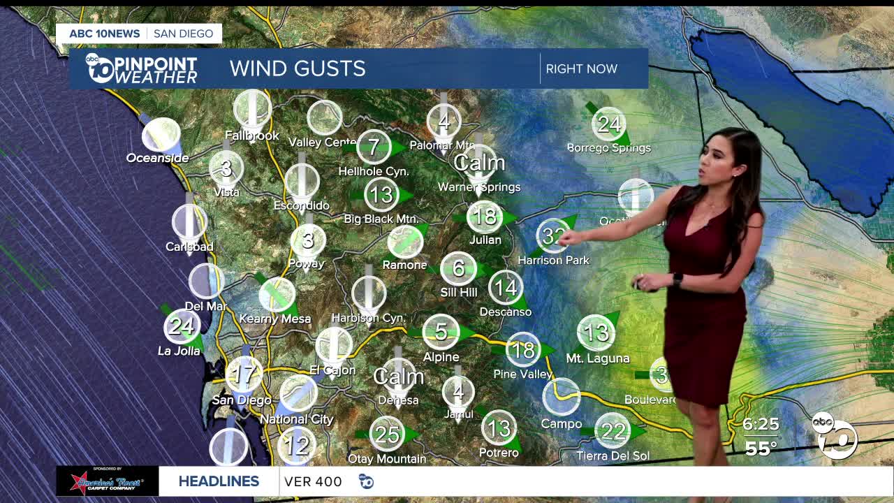

A fast-moving system brought light showers overnight, but we're starting to dry out while gusty winds linger. A good breeze impacts the coastal areas, with the strongest winds targeting the mountains and deserts. A Wind Advisory is still in place for the mountains and deserts through 11 am Tuesday for sustained westerly winds of 25 to 35mph and gusts of 45 to 60mph.
Today will be a touch cooler, with temperatures trending 3 to 9 degrees cooler than average. Early morning clouds will give way to sunny skies.
On Wednesday, temperatures will go from below average to above average for the coast and valleys, reaching the low-70s along the coast and mid-70s inland. The mountains and deserts will remain nearly below average, with temperatures in the mid-50s and mid-70s in the deserts. Warmer weather is on tap for the rest of the week there.
The storm track will be trending farther north this week, but as each storm passes, it will bring subtle changes.
The first passing storm will bring a slight temperature dip on Thursday and then again on Saturday. High pressure will build stronger Sunday into early next week, pushing storms further north and getting a significant warm-up to the county.
By Monday, the temperatures will be in the mid-70s at the coast, low to potentially mid-80s inland, low-70s in the mountains, and around 90 in the deserts!
Tuesday's Highs:
Coast: 62-66°
Inland: 61-66°
Mountains: 54-62°
Deserts: 72-75°
For the latest news, weather and traffic updates, follow Vanessa Paz on Facebook, Twitter and Instagram.
