

The marine layer returns tonight, ahead of a cold winter storm arriving Sunday.
Patchy fog will stretch from the coast to the valleys. Low clouds can be expected for the last day of the Farmers Insurance Open with highs in the low 60s.
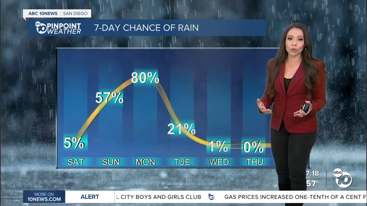
Saturday will be our transition day with a dip in temperatures and more clouds in the mix.
Light showers will begin Sunday morning, widespread rain on Monday with showers tapering off on Tuesday. Forecast rainfall totals will average between .25 to .50" for most of the county and locally up to 1" while the deserts will pick up less than .20".
This storm may be the coldest we've seen so far this season lower snow levels. Winter Storm Watch will begin at 1pm Sunday until 10am Tuesday. Snow levels will hover between 4,500' and 5,000' on Sunday dropping to 4,000' on Monday, and potentially as low as 3,000' Monday night into Tuesday. Snow accumulations in Julian could range from 1-3 inches, Mt. Laguna and Palomar above 5,000 feet could see totals from 3 to 8 inches of snow. Blowing and drifting snow could lower visibility and keep the roads slick, even after snowplows try to clear them.
Travel will be impacted by strong winds from the mountains to the deserts. Winds could gust around 40 to 60mph. A Wind Advisory will go in effect at 10am Sunday until 7am Monday.
A few showers will be possible in the east county Tuesday morning, as the storm moves east. We dry out by the afternoon, nice weather for the second half of the week.
Friday's Highs:
Coast: 65-70°
Inland: 65-73°
Mountains: 51-64°
Deserts: 68-71°
Follow ABC 10News Meteorologist Angelica Campos on Facebook & Instagram @Camposcrusher and Twitter @10NewsCampos
