
Hurricane Kay, downgraded to a Tropical Cyclone, was tracking 150 miles SE of San Diego moving north with sustained winds at 50 mph around 10A Friday.
It certainly packed a punch in terms of filtering in high winds and rain across the county early Friday.
Overnight, the big story was the hot temperatures along our inland and coastal communities. At 3A, most of our coastal neighborhoods were in the upper 80s, downtown San Diego was sitting at 89. This was the result of rapid, down sloping winds and the abundant cloud coverage locking in those warmer than average temperatures. We likely set record warm minimum temperatures, and are waiting for NWS to publish those reports.
We're certainly feeling the effects of Tropical Cyclone Kay in terms of gusty winds and heavy rain. So far, top peak wind gusts ranged from 70-100 mph, the highest in our mountains with Cuyamaca Peak clocking in 109mph gusts at 7:27A.
Coastal areas tracked gusts in the 40s, while inland valley communities recorded gusts ranging from 40-80 mph. Damaging winds with gusts exceeding 60-80 mph persist inland before weakening tonight.
There have been multiple calls of downed trees and power lines because of high winds. It's advised you report any of this activity to your local authority. A High Wind Warning is in effect for the entire county through midnight, while a Wind Advisory remains in effect Saturday for the Deserts, but winds are only expected to gust to 25 to 45mph. High profile vehicles should delay travel along the foothill and mountain areas until Saturday.
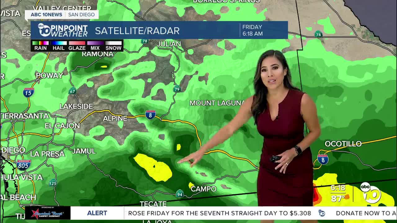
Heavy rain has been falling along I-8 in Alpine, Pine Valley, Mt. Laguna and along the Imperial/San Diego countywide but is becoming widespread. We're now seeing heavy isolated showers countywide. As of 10A, we've gotten a few hundreds of an inch along the coast, a couple tenths of an inch in our valleys and mountains, Mt. Laguna, the big winner, recording close to 3/4 of an inch.
Widespread totals of 1 to 2 inches with 2 to 6 inches in the mountains and deserts and isolated up to 8 inches are expected by Sunday as showers continue to linger through the weekend. A Flash Flood Watch is in effect through Saturday night for the inland valleys, mountains, and deserts.
Elevated surf will accompany this storm with a Beach Hazards Statement in effect through Sunday night for waves of 4 to 6 feet and strong rip currents as well as the threat for lightning. A Gale Warning is in effect Friday and Saturday for winds of 35 to 45 knots and seas of 8 to 15 feet.
In addition, we're still under an Excessive Heat Warning through 8P for our coast and valleys. Coastal communities, surprisingly, will be warmer than our deserts this afternoon in the upper 80s low 90s. Inland valleys will top out in the 90s while mountains and deserts see close to a 15-20 degree drop in daytime highs.
Expect cooler temperatures this weekend, mostly in the 80s, but also higher humidity and warmer nights as moisture gets pulled in from the storm. Moisture will continue the tropical feeling into early next week.
Cooler and drier air moves in by mid to late next week as a trough of low-pressure dives south.
Friday's Highs:
Coast: 85-94°
Inland: 87-93°
Mountains: 68-76°
Deserts: 85-93°
For the latest news, weather and traffic updates, follow Vanessa Paz on Facebook, Twitter and Instagram.
