
SAN DIEGO (KGTV) — The long-awaited cooldown is here, and Tuesday felt much more like Autumn across San Diego County. Wednesday will be like a rinse and repeat with another cloudy start, afternoon clearing, and seasonal daytime highs.
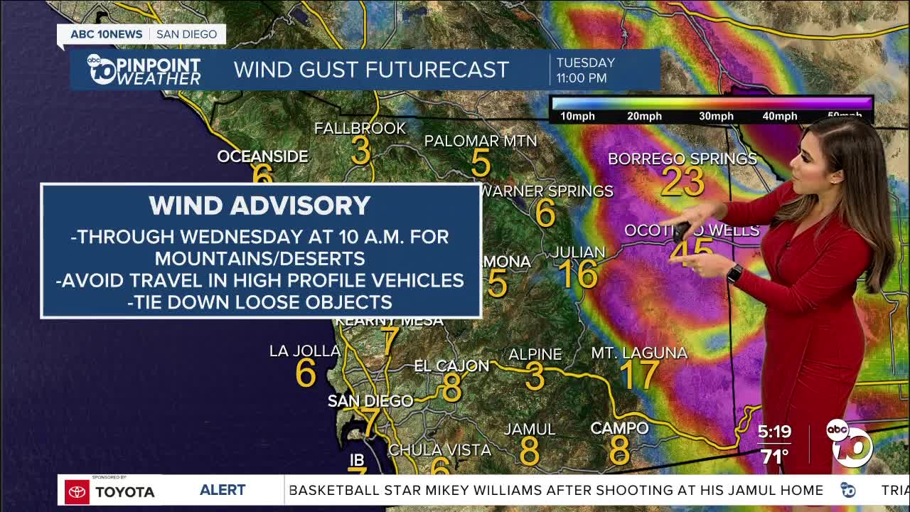
The winds are the main threat for the county's eastern half, so the mountains and deserts remain under a Wind Advisory through Wednesday at 10 A.M.
Winds out of the west will gust up to 25mph with isolated gusts up to 50mph. Those living along the foothill, mountain, and desert neighborhoods should tie down loose objects, report any downed trees, and refrain from traveling in high-profile vehicles.
As onshore flow continues, the marine layer will deepen Tuesday night into Wednesday morning, reducing visibility and producing heavy mist and drizzle.
On Thursday, we'll have a slight warm-up from a mid-level ridge that'll increase easterly flow and heat things a bit, but we'll remain near seasonal.
The significant warm-up arrives early next week when inland communities soar back into the upper 80s and low 90s. The heat-up is short-lived with gradual cooling on Tuesday.
Wednesday's Highs:
Coast: 72-75
Inland: 73-76
Mountains: 65-75
Deserts: 88-92
For the latest news, weather and traffic updates, follow Vanessa Paz on Facebook, Twitter and Instagram.
